Service Area Map
Chester Public Utility District provides water and wastewater (sewer) service within its boundaries, an area of about 1.75 square miles in and around the town of Chester, at the north end of Lake Almanor in Plumas County.
District boundary map
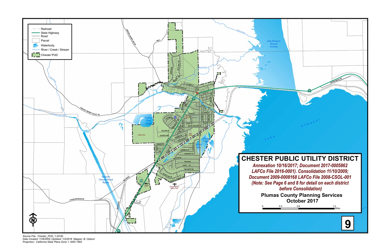
Select the map, or this link, to open the full-size version: District Boundary Map – Chester Public Utility District (PDF)
Source: Plumas County Planning Services, October 2017. The map shows the District boundary after the 2009 consolidation and the 2017 annexation, and is the most recent official boundary map the District has on file. To check whether a specific property is inside the District, call the District office at (530) 258-2171.
Statewide special district map
The California Special Districts Association (CSDA) keeps a statewide map of special districts: CSDA special district mapping program. The map may open showing a different area. Search for “Chester” or zoom in to Lake Almanor in Plumas County to find the District.
Boundary and service reviews (Plumas LAFCo)
The Plumas Local Agency Formation Commission (LAFCo) approves changes to the District’s boundaries and periodically reviews the services the District provides. These reports are posted on the Plumas LAFCo website: